
Overlanding Through Dolly Sods & Canaan Valley, West Virginia
The western portions of Virginia and West Virginia have lots of great offerings for off-road trails, including some great places to plan a little overland getaway.
While we all lust at the idea of taking weeks or months off to travel around the world in our rigs, the reality is that many of us have to be “weekend warriors” and fit our travels into 2-3 day chunks. This itinerary is aimed at you, warriors!

One of the stream crossings along the route
Day 1: Dolly Sods
Start your trip with a stint exploring Dolly Sods, and the road known as the ‘road to the sky’ — these roads are unpaved, but they are basically gravel roads, so any car can handle the route. Start your trip at the intersection of State Route 28/7 and 75 (also known as the American Discovery Trail).
There are a few camping sites along route 75 — if you plan to spend the night here, grab one and mark it with a tarp or some other gear. There is another campground in Dolly Sods called Red Creek Campground, but once you turn past the Bear Rocks Preserve area, there are no campsites to be found off the side of the road.
After about 5 miles of uphill driving, you’ll arrive at the Bear Rocks Preserve parking area. The lot itself is small, but there are plenty of places along the road to pull off and park.
The weather here can change in a jiffy, so plan and pack accordingly. I highly recommend getting out and taking a hike. The terrain here is very unique and beautiful, and there are a variety of hikes (from short, flat strolls to longer explorations) to choose from.
Spend the night either in the Red Creek Campground (which can fill quickly, and is a pay-for-use facility), at one of the sites along route 75, or continue into the Canaan Valley and Blackwater Falls area to find a site.
The appropriately named “Road to the Sky”
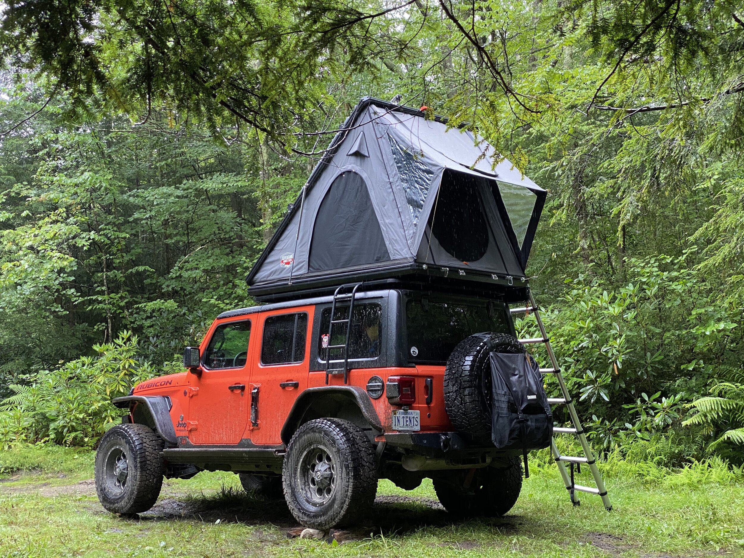
Setup (in the rain) and camping along one at an impromptu (primitive) campsite.
Day 2: Canaan Mountain Road
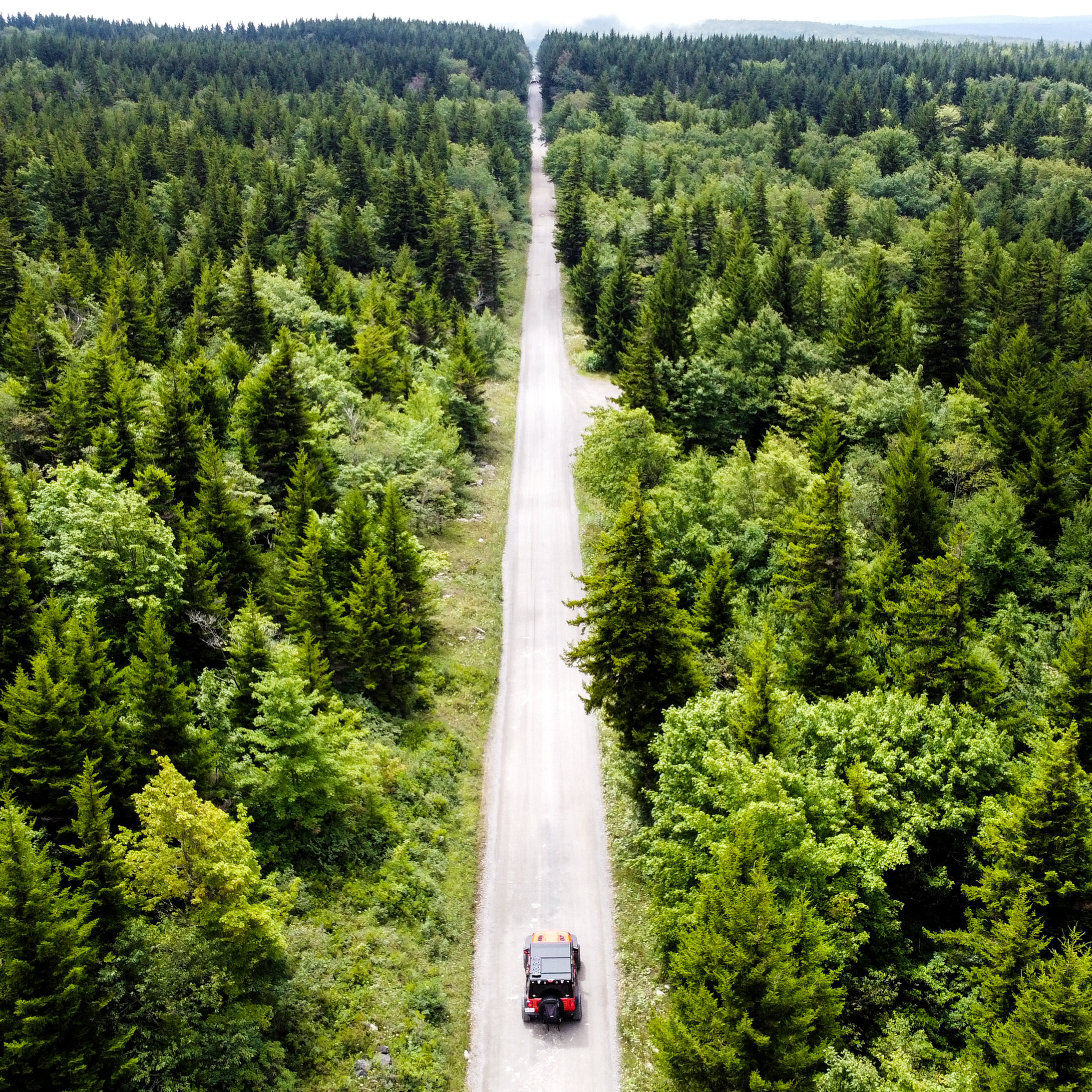
Once you are done exploring the Dolly Sods Wilderness, it’s time to move into the ridges along Blackwater Falls State Park. Exit Dolly Sods by following route 75 down into Laneville, where it will intersect Highway 32. Turn north and continue for a few miles until you reach route 13 / Canaan Mountain Road. This road is nearly 10 miles of easy gravel, so you can cover the length of it pretty quickly. Almost immediately after turning onto the road, you’ll find yourself being pulled back into the forest.
Improvised campsites are available again along this route, and they are distributed pretty well along the road.
Towards the end of the trail you’ll find the Table Rock Trailhead — this is a great little hike with a spectacular view.
Shortly past Table Rock, you’ll encounter some signs warning that the maintenance ends and only 4x4 vehicles should continue. You are now on private property.
The next four miles of trail are certainly more challenging, though easy enough for anyone who has a vehicle capable of 4 wheel drive. Air down your tires (pack a compressor to refill later), put it into 4LO, and you’re off. The trail can be a bit overgrown with rhododendron bushes, and you will get pinstripes! This trail will leave a few reminders of your awesome trip in your paint job!
Although there is nothing technically challenging on this trail, be mindful of the weather conditions. There are spots of thick mud that can be quite boggy in a heavy rain, and standing water can hide rocks on the trail. Be mindful that there are a few small river crossings on this trip, but nothing more than a few inches deep.
The trail exits at the parking lot for Lindy Point, which is technically in the Blackwater Falls State Park. You’ll know you’ve arrived because you’ll suddenly turn a corner and go from unpaved road to asphalt.
Depending on the weather and how many days you have budgeted for the trip, take some time to enjoy the hikes in this area. Lindy Point is a quick stroll, and you can head into the park and enjoy some of the other nice waterfall hikes offered in the park.

They aren’t joking with this sign! Air down and carry the appropriate recovery equipment. The trail isn’t challenging, but always be prepared.

One of the campsites found along the Canaan Mountain Road
Day 3: Canaan Valley
If you had a chance to enjoy some of the sites of Blackwater Falls State Park, then it’s time to proceed to the next part of the adventure. Start by heading into the town of Davis, WV. There are some fun shops and eateries in town, and this is a good time to refill the cooler with ice. You’ll then head west into Thomas, WV.
At the intersection of Highway 32 and Douglas Road, turn left and follow Douglas Road for a few miles. You’ll soon arrive at some signs for a parking lot to hike the short distance to Douglas Falls. This is a worthwhile stop — the falls are pretty and you can learn about the impact that decades of mining has had on the ecosystem in this area.
Continue down the road towards Backbone Mountain — State Rte 18. This is again a gravel road, but it’s not as well maintained as some of the others. Airing down your tires will make the ride considerably more comfortable. The road follows the mountain ridge for 7 miles with a few campsites along the route. There are not as many places to camp here as there are on some of the other roads, so plan accordingly.
Towards the end of the road, you’ll encounter a few trail heads and pull-offs to park and explore. You’re on the opposite side of the canyon from what you saw at Lindy Point, and depending on the season and how dense the vegetation has grown in, you might be able to find a few spots to sneak a glimpse at the canyon.
The road will dead end after 7 miles — turn right to return to the highway and go home.
But first, turn left. A few miles further up the road is the old Olsen Fire Tower, which is a neat site. You can park and get out and walk around the tower and admire the view. It was rainy and gross when we got there, so we’ll have to come back and check it out in better conditions.
Re-trace your steps back to that intersection and proceed straight to arrive back on highway 219. As you head home, enjoy a glimpse of some of the wind turbines that are on the top of this mountain!

Ambling along the northern part of the Canaan Valley

Olsen Fire Tower
On X Offroad Maps
I use the OnXOffroad app to trace my routes, and you can use my tracks to help plan your own trip. Click here to see the routes (requires the app):